 |
By David Kier
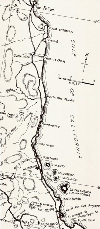
Civilization had an outpost at San Felipe, but just barely. The paved highway from Mexicali ended near the beach in town and none of the streets were paved. Finding the road south among the cross streets was not real clear, but a small sign posted for Puertecitos was attached to a structure, ¼ mile before the end of the highway.
The old dirt road to Puertecitos was graded for its 51 miles and wide enough for vehicles to pass by without leaving the road. The first 20 miles were mostly sandy with the typical washboard surface. The road was maintained by the owner of Puertecitos who re-scraped it smooth every few years. Side roads to Punta Estrella and Percebú headed east as the coast was several miles from the old road. The side road to Punta Estrella passed through an impressive cardón cactus forest that today is known as the ‘Valle de los Gigantes’. Mexico supplied the 1992 World’s Fair in Spain with one of the giant cardóns taken from here.
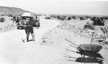
Percebú was a commercial fishermen’s camp with a single covered work area to escape the sun. One of the fishermen placed an octopus tentacle on my mother’s arm to demonstrate how the suction cups worked. In the 1970’s, it developed into a tourist camp under the name Laguna Percebú. Beginning about 22 miles from San Felipe, the road passed through a valley that was rich in sulfur deposits and the location of a mine, shown on some maps with the name ‘El Apache’. It operated here during the 1950s and was then abandoned. In the 1960’s, ore crushing machinery, boiler tanks, and other mine equipment could still be seen. Plenty of yellow sulfur is up the hillsides and if you put a lit match to a piece, you can see that rocks do catch on fire and burn.
A side road traveled about 5 miles east from the sulfur mine to a beautiful beach, near a well called Agua de Chale. The place was originally a goat ranch owned by ‘Charley the Chinaman’ in the early 1900’s. ‘Chale’ is the Mexican map maker’s spelling for Charley. In 1965, Luis Castellanos Moreno claimed the land and changed the area name to Nuevo Mazatlan. He built shade structures out of ocotillo and cardboard, as this would attract campers to his beautiful sand beach. Luis later planted cuttings of a nearby salt cedar tree and grew a shade forest for campers that survives to this day. Until 1956, this was the furthest south you could drive by road. In April of that year, Arturo Grosso blazed a 4WD track from his ranch at Laguna Chapala north to Bahía San Luis Gonzaga, Puertecitos and finally to Agua de Chale and the sulfur mine. The governor offered a reward to anyone who could get a vehicle through to San Felipe from the south. The next year, government road crews began to improve the road south.
Click to view the coast map from San Felipe to Gonzaga BayThe coast is still miles from the road as you headed south of the sulfur mine. In the mid 1960’s there was one fishing resort, called El Coloradito, about 12 miles from the sulfur mine. At extreme low tide, thermal hot water comes up through the sand and rocks near the fish camp.
The road next crossed the broad Arroyo Matomí dry riverbed. About 35 miles up the desert wash is an oasis of blue palms with running water and a small waterfall fed natural pool. Flash floods occasionally make the drive there impassable from the Puertecitos road. As with most of Baja in the 1960’s, it is best to have a four wheel drive with over-sized tires.
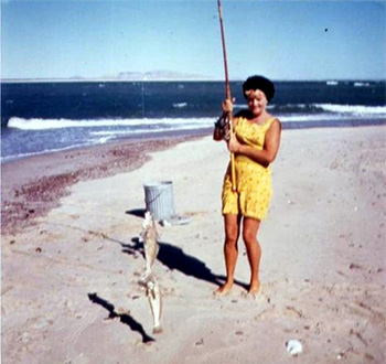
Just two miles north of Puertecitos the road comes to the coast and in the late 1960’s a fish camp called Corvina Beach had begun here. Over a hill, and you arrive at the fishing resort of Puertecitos on a small bay that faces to the south. Several travel trailers and mobile homes are set up around the bay. The Gulf of California is famous for the sport fishing possibilities and Puertecitos is much closer to the Enchanted Islands than San Felipe, making it a popular boat launching location. The launch is near the end of the point that creates the small bay here.
The other popular activity at Puertecitos is soaking in the hot spring. Located on the open sea side of the point, the gulf water mixes with the hot sulfur water and the temperature varies with the tide level. Several pools in the natural rock are reached by a paved path from the parking area, above. In the days of dirt roads, the soothing hot water soak was much appreciated. The rotten egg smell of sulfur must be ignored.
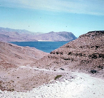
Fifty years ago, most considered Puertecitos the end of the road… but that wasn’t entirely true! Soon, the road south would climb (and drop off) a series of steep, volcanic ridges. Many a wrecked car could be seen below and crosses lined the rocky road. Only four wheel drives and rear-engine VWs could safely drive to Bahía San Luis Gonzaga, another 50 miles south. Those with good tires, low gears, and as much traction control as possible would find the beautiful beaches and fine sport fishing a major attraction.
Along the way to Gonzaga Bay were the fishing camps of El Huerfanito and Okie Landing. These camps were directly across from the Enchanted Islands, so named because as rocks break off of them, they float! Volcanic pumice is so light and filled with air pockets, it won’t sink. In this area of Baja, Gold and onyx had been mined. The stone ruins of a storehouse for the Miramar mines were passed halfway between Puertecitos and Gonzaga Bay. The drive to Gonzaga from Puertecitos took about five hours. Fifty years later, it takes just one! Will Gonzaga Bay continue to be appreciated with a paved highway now there? Only time will tell…

I've used Baja Bound many times. I've purchased online with no problems. I will keep using them....

2nd time I have used this company,, first class service and great price.

Save the hassle of trying to find a Mexican Insurance shop or waiting in line if you do. Baja Bound...